CSX's S-Line that once was the Seaboard Air Line Railroad into Florida and is now leased to First Coast Railroad; CSX's A-line that was the Atlantic Coast Line's main line into Florida and is CSX's primary artery into the Sunshine State; and the Norfolk Southern's Georgia Southern and Florida Railroad line that ran from Macon through Valdosta to Jacksonville and is NS's main link to Jacksonville's seaports and the Florida East Coast Railway. Their respective bridge crossings were built in 1886, 1881, and 1900; each span have been rebuilt over the years on the same right of way except the ACL drawn span which was realigned to remove two sharp curves and double tracked in the first decade of the 1900s. (The old 1881 brick pillars on the Georgia side still survive in the thick wetland vegetation and the one on the Florida side serves as a central core of a water front residence.) Despite it being only 20 miles from my home, today I visited the Norfolk Southern Railway bridge across the St. Marys River. Although I am a die-hard truss span fan (like the A-line rail crossing in Boulogne) and love swing-span bridges (like the S-line rail crossing north of Yulee, although it is locked in place and can not be opened except by special permission), I have now a great admiration for this 1230 foot span that the thoroughbred engines of the NS run across every day.
The trestle approach on the Florida side is only 190 feet long as that side is part of the Alachua Ridge that runs along the western edge of Nassau County. This high ridge is what prevents the St. Marys from turning east and prevents the river's overflow from flooding the Nassau County side during heavy rains. This short trestle section is followed by the first 60-foot girder which then is connected to the 100- foot main span of the bridge.
The second 60-foot steel girder is sandwiched between the main span and another 100-foot long girder and is support by steel pilings capped with concrete. It is unclear why this girder is shorter than the rest.
The remains of the old wooden pilings from the first bridge jut up from the ground underneath the 2 far western long girders. When the river floods, these jagged pieces of wood are hidden under the suddenly swift currents of the tea-colored river.
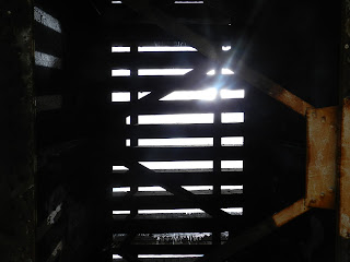
The shadows of the girders make their own set of tracks on the ground below the bridge.To make them lighter, the girders are hollow. One the left edge of the shadow are the remains of rusty I-beams that have been cut off at ground level.
The western most long girder shares a pylon with the beginning of the Georgia half of the steel trestle.
The old wooden trestle pilings have long since been replaced by steel pylons, judging by the brown patina of the graffiti-covered I-beams.


No comments:
Post a Comment