Friday, May 31, 2013

CSX's Callahan-Baldwin sub update from MM 0.0 to MM 20.0: May 31, 2013

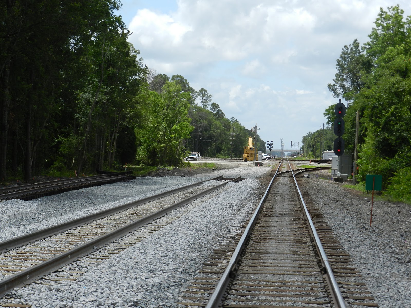
Pre-fab tracks sitting at the Oliver Street grade crossing in Baldwin (MM 0.05) are waiting to be used somewhere along the 20 mile upgrade of the Callahan-Baldwin sub. In the foreground is the Callahan-Baldwin sub looking south toward the diamond with CSX's western line from Jacksonville to New Orleans. This diamond (built in late 1856 when the Atlantic and Gulf Central RR on its westward course crossed the Florida Railroad and its freshly built, southward pointing grade) use to be a single track Seaboard Air Line diamond with matching connecting tracks in all four corners. Over time the junction as changed. The turnout in the northeast corner has been removed and the turnout in the southeast corner has been double tracked to handle trains bypassing the Baldwin yard such as Amtrak. Part of the Callahan-Baldwin sub upgrade is the addition of a new connection track in the SE corner as seen in the recent update to google maps satellite view. (the existing inner turnout will be removed, leaving only 2 connection turnouts connecting the Wildwood and Jax subs) A 3-mile section of track east of Baldwin toward Jacksonville has been double tracked with a double crossover and the turnout in the southwest corner parallels the main line westward for 1.5 miles with a double crossover. The northwest turnout has remained the same for years but the prefab track in the foreground might mean they may double track this turn out. (I have found out since that the NW connection track will remain single. The prefab track will be used somewhere on the Callahan Sub) With more trains being funneled from CSX's A-line which parallels US 17 from Jax to Tampa onto their S-line that parallels US 301 from Callahan to Zephyrhills, this turnout needed to be upgraded.

 Looking south from Oliver Street (mm 0.05) toward the US 90/301 grade crossing (mm 0.18). The old abandoned turnout in the northeast corner of the Baldwin diamond is just out of the right frame of the pic. Evidence of the raised bed of this turnout still can be seen where it once crossed Oliver Street.  The clearing of trees and brush in the right of the picture may be evidence that CSX may reconstruct the northeast turn out again.

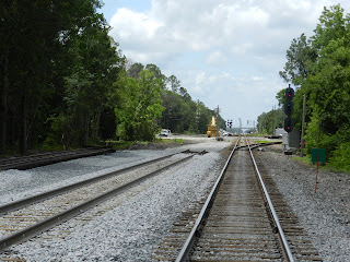
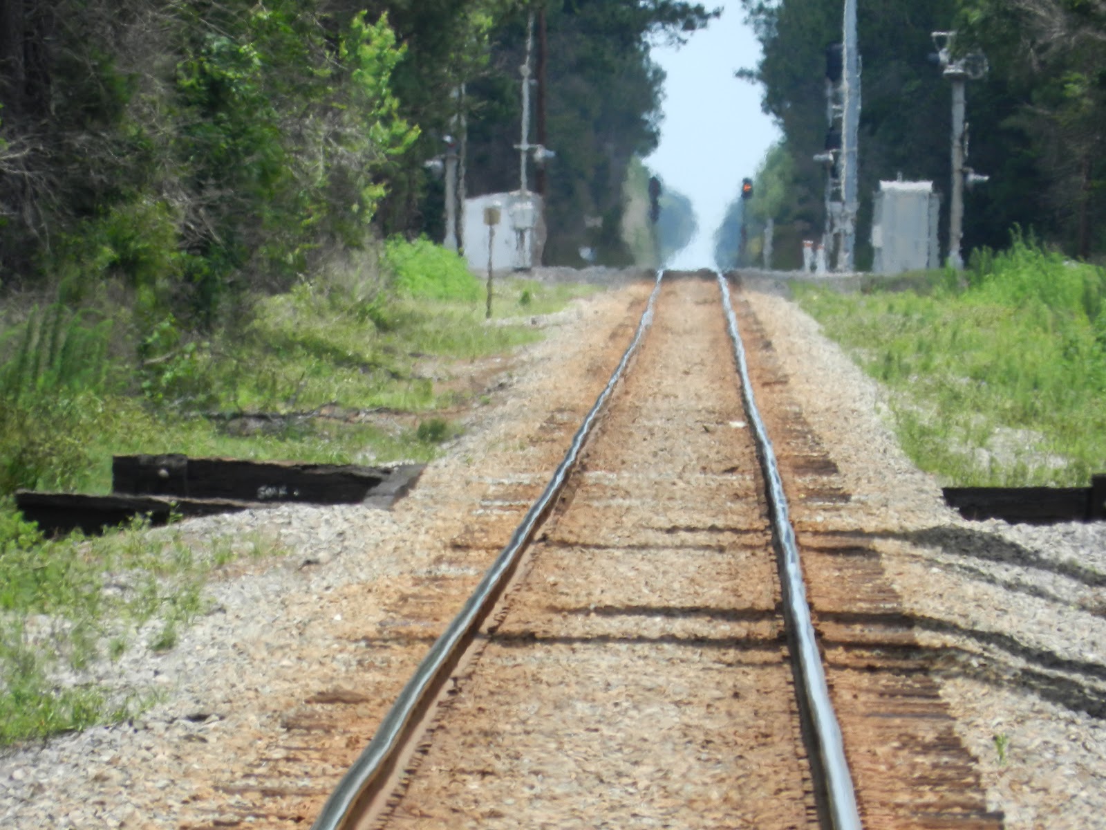
 Looking south from the US 90/301 grade crossing (mm 0.18) in Baldwin. The crossing was just reopened an hour or two before this picture was taken for vehicular traffic. The original single track and unchanged northwest turnout to the CSX Tallahasse sub is to the right. The Baldwin diamond and yard are in the background. It appears that the new track to the far left might be the beginnings of the relaying of the northeast turnout. The middle track may either go into the Baldwin yard or connect to the bypass turnout in the southeast corner of the diamond so through trains from Callahan can bypass the yard.

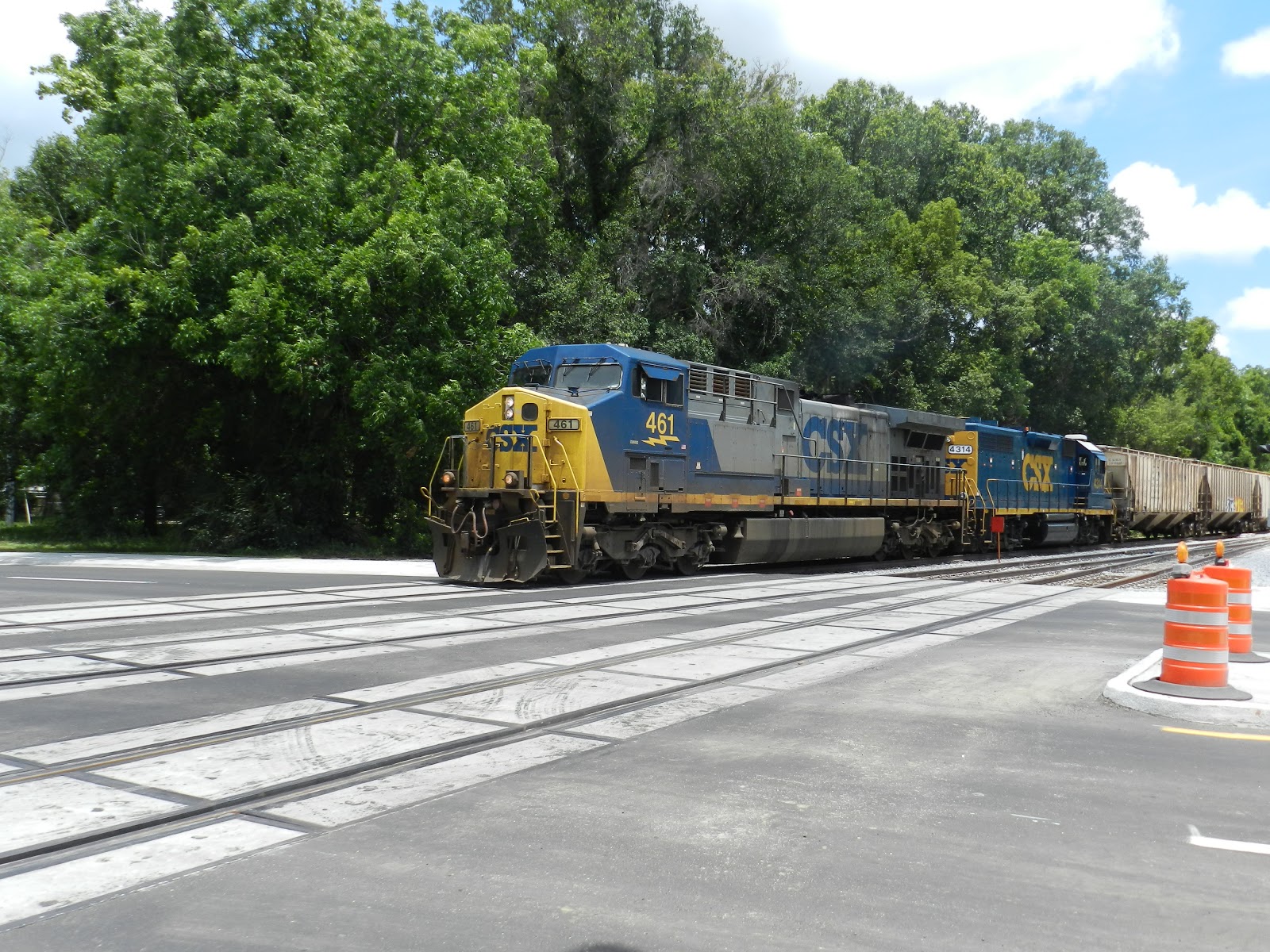
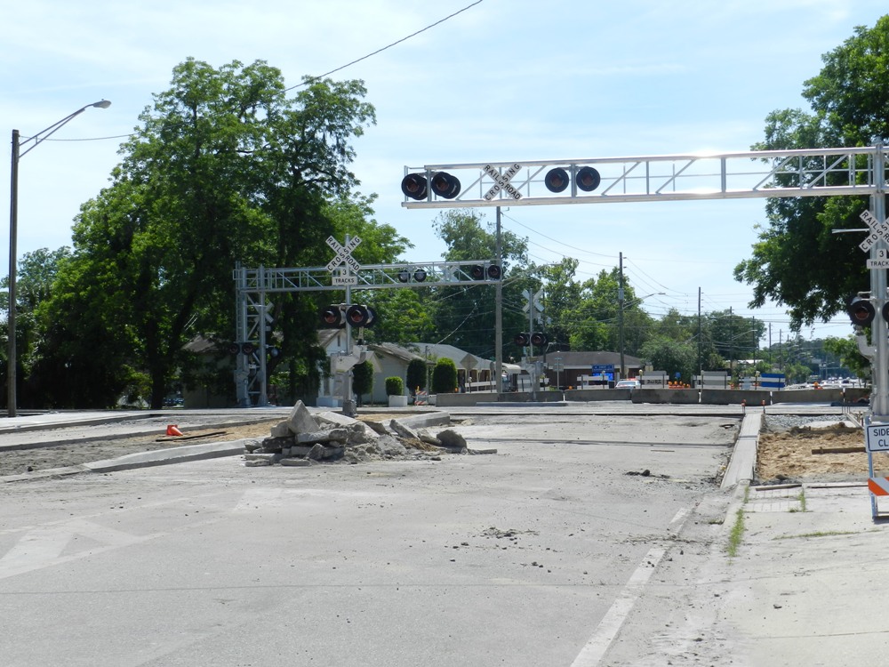
A CSX manifest train with engine 461 at the point pulling engine 4314 and various freight cars through the newly reopened US 90/301 grade crossing in Baldwin.  Each side has new overhead signals with digital lights that stretch over the traffic lanes. A new signal with crossing arm was added in the median so traffic is now stopped by matching crossing arms. The was already a grassy median on the eastern side but a concrete median with a matching crossing arm signal was added on the western side of the crossing.

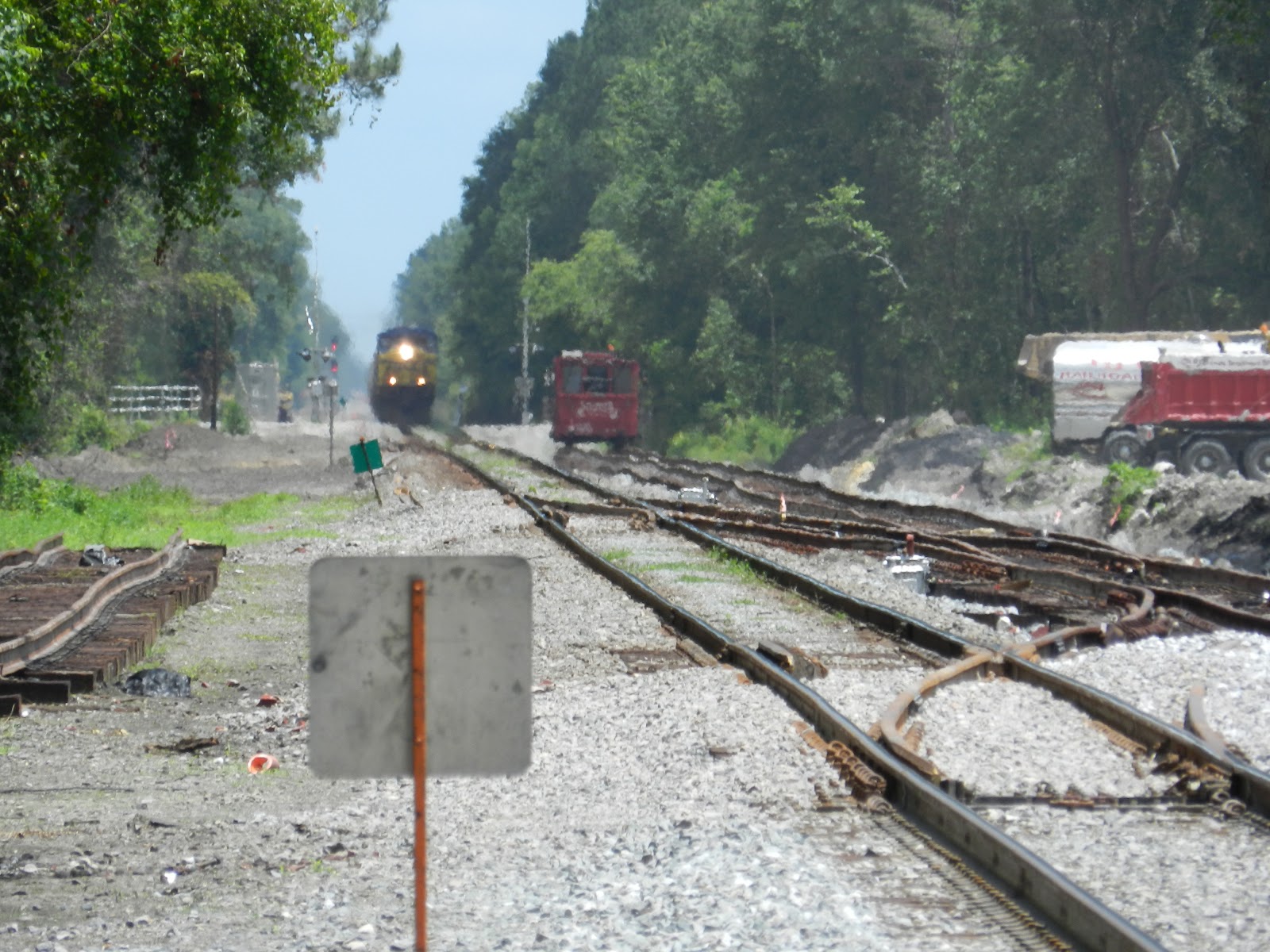
Looking north from the US 301/90 grade crossing as the southbound freight (pictured in the previous photo) approaches from its run from Callahan. The third track (pictured in the second photo above this one) has merged into the  new track shown to the right of the mainline. A new double cross over has also been added so I am sure track signals are soon to be added here.

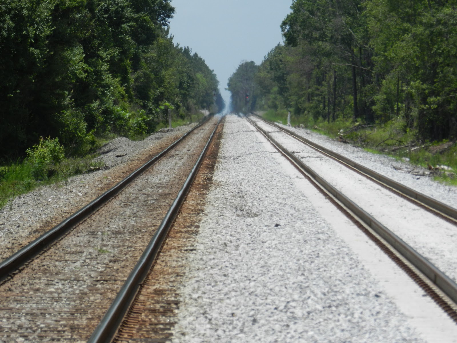
Looking south from the Jax to Baldwin Rail Trail grade crossing (mm 0.75) toward the US 90/301 grade crossing.  The grade has been widened and cleared for the second track.

Looking north from the Jax to Baldwin Rail Trail grade crossing (mm 0.75) at a new signal. The grade has been widened and cleared for the second track. This section will soon be double track to the south end of the Fouraker Siding (mm 3.6)

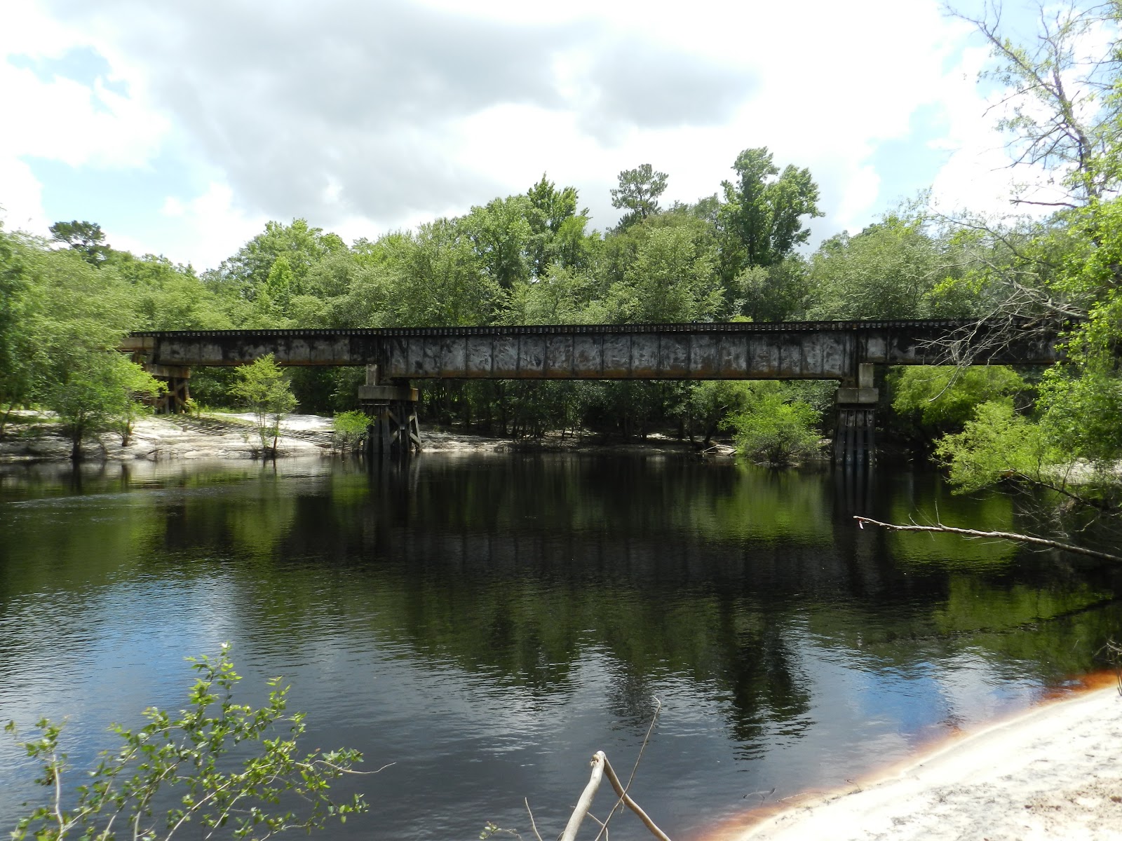
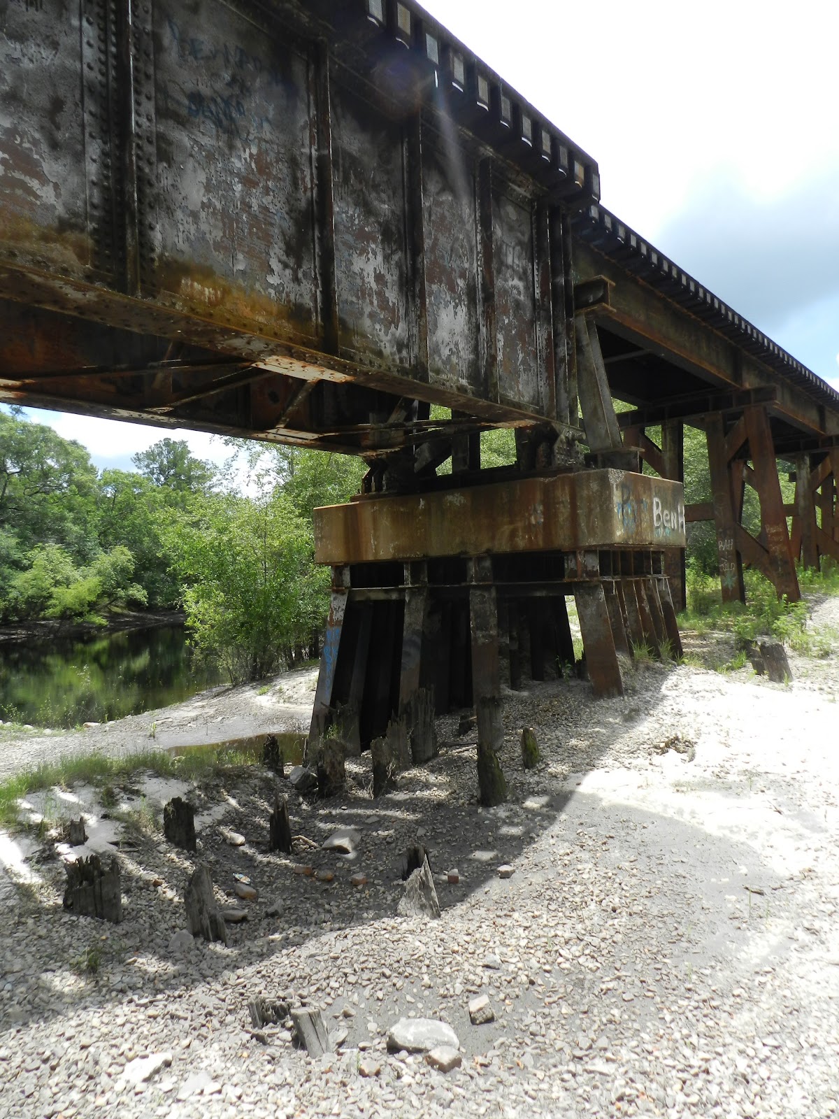
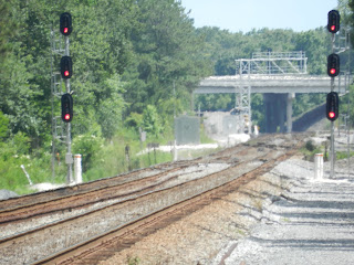
 Looking south toward the new tri-lighted track signals (background) have been added and are in operation at the north end of the Fouraker Siding (mm 5.7).  The siding, named for a pioneering family that settled the area, is relatively short by today's standards, measuring about 7500 feet. In the middle ground are the twin Brandy Branch trestles that will need to be widened if CSX is planning to double track the entire 20 mile section.
 Looking north at the CR 119 grade crossing (mm 7.1) in Bryceville, Nassau County, FLA. The trestle in the foreground matches another trestle that lies in between the grade crossing and the track signals in the back ground (mm 8.7).  At present there are no visible upgrades until you reach the new extension of the Crawford siding at mm 10.1 now visible in google maps.

 Looking south on the Brooks Road grade crossing (mm 13.3) in Dahoma, Nassau County, FLA, at the double track extension of the Crawford siding. The new southern end of the "siding" is at now at mm 11.5, making the new double tracked section 4 miles in length.  CSX has added flashing signals (with the new LED warning lights) with crossing arms at this grade crossing which is a dirt road that serves about 2 dozen families who live on the western side of the tracks.

 Looking north from the Brooks Road grade crossing (mm 13.1) in Dahoma, Nassau County, FLA. The south end of the old Crawford siding ended about 1/2 mile from this crossing. The busy siding was used for southbound trains waiting to enter the Baldwin Yard and northbound trains waiting to enter CSX's A-line, the main artery out of Florida.  As part of the sub upgrade, the old south end has been converted into a double crossover (mm 13.6). This section of CSX track was part of the old Florida Railroad, the Sunshine State's first trans-peninsular railroad.  The 155-mile long railroad ran from Fernandina, Nassau County, FLA, (mm 0) to Cedar Key on the Gulf of Mexico (mm 155).  Callahan was mm 27 and Dahoma at this curve was mm 33.  Once the railroad weaved through all the swamps and creeks in Nassau County, FLA, it was able to turn southwest and make a bee line inland. This Dahoma curve is the last curve on the Florida Railroad (and Seaboard Air Line RR) until the railroad reached Waldo at mm 83.

Looking south from the Crawford Diamond, the new track signals are in operation and old ones removed at the northern end of Crawford Siding at mm 15.5, making the new double-tracked section 4 miles in length. Plans are to extend these two tracks northward to Callahan and complete the connection.  The old south end of the Crawford Siding (just beyond the parked train and before the curve in the far distance) is now a double crossover, but looking at the updated satellite views on Google maps, they may be adding a third track to the west of these two existing ones.  Terra Pointe's plans for building the Crawford Diamond Industrial Park in the northwest corner of the Crawford Diamond are hitting high gear therefore they may be added a new siding to this growing area of Nassau County. Link to Terra Pointe's Crawford Diamond info. http://www.terrapointeserviceslandsales.com/ViewProperty.aspx?propertyID=110

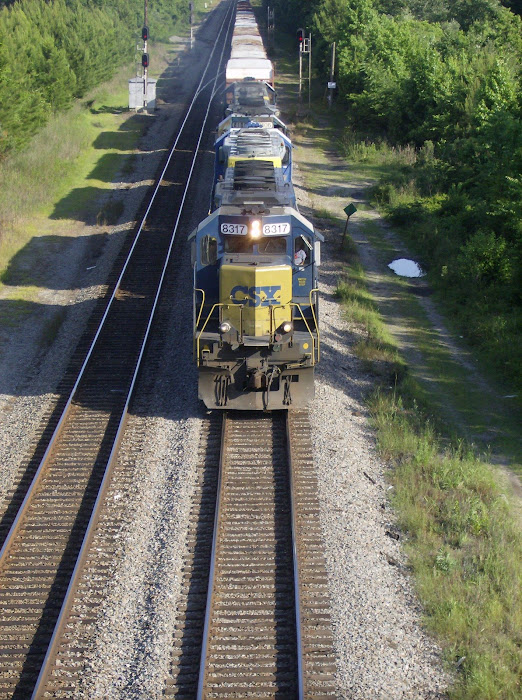
 Looking east toward the Crawford Diamond, both CSX and Norfork Southern (NS) have turned on their new track signals and are removing the old ones, including these NS (foreground) and CSX (background) signals pictured here.

 The new track signals are in operation at the new double crossover just north of Sandy Ford grade crossing (mm 18.5). The tracks pictured here will be extended southward and connect with the old north end of Crawford Siding, creating a double diamond at Crawford junction with Norfork  Southern mm 15.7).

                                 
Looking south, new signals guard the double crossovers on the main CSX line (mm 624) just above the double turnouts to the Callahan-Baldwin sub at mm 20.0. Notice in the background there is a shy CSX northbound engine parked underneath the US 301 viaduct. It is very unusull for a train to be parked there. In fact, the engineer was backing the train up about 5 minutes before I took this photo.

The Norfolk Southern (NS) bridge over the St. Marys River, Nassau County, FLA

The St. Marys River flows in several directions as it makes its way from Okefenokee Swamp to the Atlantic Ocean. Marked by Endicott's Mound, it begins its journey out of the Swamp in a southerly direction. It then curves eastward and cuts through Trail Ridge, a high piece of narrow ground that runs north-south from Micanopy, Florida, to the Satilla River in Georgia. The tea-colored river then hits another stretch of high ground called the Alachua ridge. It is forced to turn northward where it meanders for about 40 miles before again curving eastward. It winds for another 50 miles before making its final run as a swift, wide river that divides two barrier islands, Amelia and Cumberland. It serves as the northern and western edge of Nassau County, FLA. Three railroads cross the St. Marys:
CSX's S-Line that once was the Seaboard Air Line Railroad into Florida and is now leased to First Coast Railroad; CSX's A-line that was the Atlantic Coast Line's main line into Florida and is CSX's primary artery into the Sunshine State; and the Norfolk Southern's Georgia Southern and Florida Railroad line that ran from Macon through Valdosta to Jacksonville and is NS's main link to Jacksonville's seaports and the Florida East Coast Railway. Their respective bridge crossings were built in 1886, 1881, and 1900; each span have been rebuilt over the years on the same right of way except the ACL drawn span which was realigned to remove two sharp curves and double tracked in the first decade of the 1900s. (The old 1881 brick pillars on the Georgia side still survive in the thick wetland vegetation and the one on the Florida side serves as a central core of a water front residence.)  Despite it being only 20 miles from my home, today I visited the Norfolk Southern  Railway bridge across the St. Marys River. Although I am a die-hard truss span fan (like the A-line rail crossing in Boulogne)  and love swing-span bridges (like the S-line rail crossing north of Yulee, although it is locked in place and can not be opened except by special permission), I have now a great admiration for this 1230 foot span that the thoroughbred engines of the NS run across every day.

The trestle approach on the Florida side is only 190 feet long as that side is part of the Alachua Ridge that runs along the western edge of Nassau County.   This high ridge is what prevents the St. Marys from turning east and prevents the river's overflow from flooding the Nassau County side during heavy rains. This short trestle section is followed by the first 60-foot girder which then is connected to the 100- foot main span of the bridge.
 
 The NS bridge consists of five spans: three 100-foot long steel girders and two 60-foot long girders that aren't as deep as the other three. The far eastern long girder spans the main channel of the St. Marys River which curves sharply under the span which makes traveling the waterway a bit tricky.  For generations tall-mast schooners and steamships sailed up the deep St. Marys River as far as Traders Hill, Georgia, just west of Boulogne, Nassau County, FLA. This is why the other two rail bridges were swing spans at one time or the other. Since this Norfolk Southern bridge is located south of Traders Hill, thus south of the point where ships could navigate the St. Marys, there was no need for a movable span. I believe the original span was a wooden truss span, but I have not found any evidence of this.

The second 60-foot steel girder is sandwiched between the main span and another 100-foot long girder and is support by steel pilings capped with concrete. It is unclear why this girder is shorter than the rest. 

 The remains of the old wooden pilings from the first bridge jut up from the ground underneath the 2 far western long girders. When the river floods, these jagged pieces of wood are hidden under the suddenly swift currents of the tea-colored river.


The shadows of the girders make their own set of tracks on the ground below the bridge.To make them lighter, the girders are hollow.  One the left edge of the shadow are the remains of rusty I-beams that have been cut off at ground level.
 
 
The sun peaks through the opening of the open-topped girder, exposing the cross ties and rails of the track.

The  western most long girder shares a pylon with the beginning of the Georgia half of the steel trestle.
 
 
At 620 feet, the western trestle approach is longer than its Florida counterpart because it has to traverse the lower flood plain on the Georgia side of the St. Marys River. It is held up by a series of massive, steel pylons.

 The old wooden trestle pilings have long since been replaced by steel pylons, judging by the brown patina of the graffiti-covered I-beams.

Thursday, May 30, 2013

Work Continues on Callahan-Baldwin sub in Baldwin

Some railfan trips are eventful; others aren't so much.  I started out following a SB CSX manifest train as it entered the Callahan- Baldwin Sub (milepost 20).  I took a pic at mm 16 north of the Crawford diamond, but by the time I had reached Dahoma (around mm 13), the train had pulled onto the Crawford siding south of the NS diamond.  I  waited a bit for it or a Northbound train to come, but was denied, so I drove to Baldwin at milepost zero of the Callahan-Baldwin sub.  It is in Duval County but it plays an important part the CSX network.  CSX is busy double tracking the southern end of the 20-mile long Callahan-Baldwin Sub.  They had closed the busy US 90/301 grade crossing to vehicular traffic, much to the frustration and display of Memorial Day weekend travelers driving on US 301.  I think they are double tracking the sub up to the Fouraker siding (milepost 5) in Bryceville, Nassau County, FLA. 
Looking south toward the Baldwin yard and US 301/90 grade crossing from where the Baldwin-Jax rail trail crosses at milepost 0.75. The much used Baldwin-Jax rail trail follows the old Jax and Southwestern Railroad line (J&SWRR ) from the westside of Jacksonville through Baldwin to SR 121 near Brandy Branch, Nassau County, FLA. The J&SWRR opened in 1896 and ran from the Cummer Logging Mill on the St. Johns River in Panama Park, Jax, to Newberry, FL, and the Cummer land holdings.  The Atlantic Coast Line RR took over the line in 1902 and turned it into their second line from Jax to Tampa to take traffic off of their A-Line that ran from Jax to Orlando and on to Tampa. Today the trail is heavily used by cyclists, walkers and equestrians alike. One day Nassau County will connect into this very popular path.
A southbound CSX manifest train heads slowly down the Callahan-Baldwin Sub at mm 16 just north of the Crawford diamond.  The new track signals added in Callahan are now operational.
Looking at the US 90/301 grade crossing where CSX is adding another track. In the background are the Baldwin yard towers and I 10 overpass.
This single track grade crossing (mm 0.15 on the Callahan-Baldwin sub) was notorious for being blocked by slow moving CSX trains leaving and entering the Baldwin yard.  Traffic on US 90 had the alternative of using I 10 but those traveling US 301 had little choice but to sit and count the cars as they slowly crawled by. CSX has replaced the old gates and signals with new ones, complete with crossing arms in the median.  The new signs state that there now are 3 tracks instead of one.  On my next trip to Baldwin I will investigate this new configuration further south at the Oliver Street grade crossing just north of the diamond with CSX's Jax-New Orleans line.

Saturday, May 11, 2013

Amelia Island Trail (AIT) officially opened today in Fernandina Beach, Nassau County, FLA

The Amelia Island Trail (AIT) officially opened today in a ribbon-cutting ceremony at Peter's Point Park in Fernandina Beach, Nassau County, FLA.  Phil Scanlan, head of the Amelia Island Trail team, hosted the 45-minute ceremony attended by federal, state and local officials and by area community leaders and volunteers who helped make the 6-mile long paved off road trail a reality. Mike Pikula, President of the Friends of the Amelia Island Trail and key member of the AIT team, also spoke. The grand opening of the AIT was well attended by several hundred cyclists, joggers, runners and walkers of all ages.  The event was capped off with Nassau County Commissioner and North Florida Transportation Planning Organization Chairperson Danny Leeper given the honors of cutting the ribbon. The AIT is also part of the larger East Coast Greenway, a multi-state, 3,000 mile trail that when fully completed will stretch from Maine to Key West. Construction will soon begin on the Big Talbot Island trail that will connect the AIT with the newly completed Little Talbot Island trail. For more info on the AIT, the Friends of the Amelia Island Trail, or the East Coast Greenway, check out the links below.
http://ameliaislandtrail.org/index.html
http://www.greenway.org/index.shtml
Nassau County Commissioner and North Florida TPO chairperson Danny Leeper cuts the ribbon at the official opening of the AIT as those who helped make the decade-long dream 
a reality stand beside him.

 Phil Scanlan, head of the AIT team,  hosts the opening ceremony held today at Peter's Point park in Fernandina Beach.

 Mike Pikula, President of the Friends of the Amelia Island Trail and key member of the AIT team, speaks to the crowd of several hundred cyclists, jogging and walking enthusiasts.

 The crowd, led by the cyclists, leave Peter's Point Park and head onto the AIT. Many of the biker riders were from the North Florida Bike Club.  Joggers and runners soon followed behind them onto the trail.  The AIT team are planning to erect a kiosk nearby to mark the northern entrance to this section.

The AIT was built on the state owned right of way of SR A1A by the Florida DOT with funds from the North Florida TPO. It runs from Peter's Point Park to Amelia Island State Park, a total of 6 miles.  It will be connected to the south by the Big and Little Talbot Island Trails. The AIT will also extend north through Fernandina Beach, connecting neaby schools, parks, and community centers along the way. A passenger ferry was to connect the AIT to Georgia and the northern part of the East Coast Greenway, but unfortunately the privately owned ferry is no longer in service.
 

Cyclists enjoy the shade of the tree-lines trail.  Although it parallels SR A1A for its entire length, the AIT weaves in and out of the canopy-lined road. Many parts of the trail are barely visible from SR A1A, especially the southern half, giving the trail a rural flavor.
 
 
A sign post shared by the AIT and East Coast Greenway logos marks the AIT's southern entrance at Amelia Island State Park.  Construction of the Big Talbot Island link will begin shortly and will allow riders to continue south into Duval County and the Talbot Islands State Park via the Crady Bridge spans the Nassau Sound.

Friday, May 10, 2013

New track signals added on CSX's Callahan-Baldwin sub at milepost 18.2

New "Darth Vader" signals have been added to guard the south end of the new crossover being added on the Callahan-Baldwin sub at milepost 18.2 just north of the Sandy Ford Road grade crossing.  The crossover and signals are part of the double tracking of the CSX S-line between Callahan (mp 20) and the Crawford siding (mp 15.5). Once in operation, the newly expanded tracks will handle the increase in rail traffic funneled off the CSX mainline at  the Callahan Junction.  CSX has sold their A-line through Orlando to the State of Florida for the new Sunrail commuter train. Since they will not be able to use this main artery during the day, CSX will divert much of their southbound freight trains to the S-line in Callahan which parallels US 301 to Zephyrhills. The red construction cars in the foreground are parked on what will be the new west track of the  S-line.

Railfanning in Keen, Nassau County, FL

When it comes to railfan hot spots in Nassau County, FL, the now-vanished hamlet of Keen (or Keene) is not among them. Yet, the Thomas Creek Road/Ratliff Road grade crossing on the Norfolk Southern Railway (NS) line just south of the Norris Siding at Keen does have its moments. Just today while traveling southbound on US 301 I spotted a southbound NS intermodal train crossing under the US 301 Viaduct at Crawford. It was doing below-average speed for an intermodal on a Friday so I veered left on Thomas Creek Road which parallels NS's Valdosta-Jacksonville line (it was built around 1900 as the Georgia Southern and Florida Railroad). It had already cleared the north end of Norris siding (not sure where that name came from) but by the time I made it to Keen, it had stopped just before the south end of the 2.3 mile long siding. I stopped next to the Thomas Creek Road grade crossing (at the intersection of Thomas Creek and Ratliff Roads) and got out. To my surprise the SB intermodal had not only stopped (intermodals are usually high balling to the ports or trying to make the Florida East Coast Railroad (FEC) connection at Bowden Yard), it stopped on the main line and not on the siding.  I figured at first it was waiting on the okay to proceed onto the NS's Simpson Yard in Jacksonville then I noticed the bottom light of the NB track signal was yellow which indicated a NB train had to pass first. (The old NB track signal always had a bottom yellow-top red because of the sharp curve trains had to negotiate just before passing under the US 301 viaduct in Crawford. It only had a red bottom-red top signal when a SB train was on the line).  After about a 15 minute wait I heard the faint whistle of a northbound NS train blowing at the Acree Road grade crossing just to the south of the Duval-Nassau line. I took a pic of the train (pulled by NS locomotives 8842, 9365, and 9821)  as it dipped down and over the Thomas Creek trestle. I took some more as it blew its warning for the Larsen Road and Thomas Creek Roads grade crossings. The engineer waved as he slowed the locomotive down and entered the north end of Norris siding. I figured the dispatchers had him enter the siding (as opposed to having the other train wait on the siding) so that the NB could clear the main  line then wait on the siding for possibly another SB train.  I wanted to drive to Crawford and see if my hunch was right or if the NB slowly reentered the main line without stopping, but duty called and I had to go. However, thanks to my initial spotting of the SB intermodal, I was able to snap some good photos of the oncoming trains. Maybe I need to stop in Keen more often or split my rail fanning time between it and Crawford.

 A southbound Norfolk Southern (NS) intermodal waits on the main line of the old Georgia Southern and Florida RR's (GSF) Valdosta-Jacksonville line. The yellow light on the bottom signal of the new "Darth Vader" track signal means a northbound train will soon make its way from Jacksonville.

 A northbound NS trains blows its whistle as it approaches the Acree Road crossing in Duval County. The Thomas Creek trestle is at the bottom of the dip.

 
 After crossing the short bridge and passing the Larsen Road grade crossing, the Northbound manifest train blows it whistle for the Thomas Creek grade crossing as the crossing bell chimes its impending arrival.


Slowing down to a near crawl, the northbound train prepares to enter the north end of Norris siding. The middle light of the track signal changed to green for a brief moment then both middle and bottom lights changed to red after the train crosses the small creek bridge and passes the track sentinel.